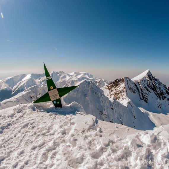
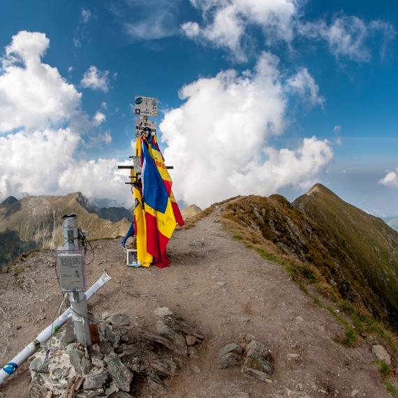
Fagaras – Vf Lespezi, March 2015
On a fine March morning we set out to climb one of the tallest peaks in Romania.
From the starting point – Piscul Negru chalet (1200m) we follow the track marked with a red dot symbol, and after roughly 40 minutes of climbing trough the forest, we reach this point, known for the close-by sheep ranch, now deserted for winter.
Continuing along the marked path, we follow the boot prints of hikers in front of us.
At this point, we leave the pine trees behind us. The peak is plainly visible in front, clearly stating that we are not there yet.
Finally we reach our destination, Lespezi peak, at 2522m altitude. The views are just breathtaking. Towards north we can clearly see Negoiu Peak and if we look to our NE we can even see Vistea – Moldoveanu ridge. Towards south the Transfagarasan alpine road follows the curves of Vidra lake, and towards SW we can even spot Cozia Mountains.I hope you enjoyed the panos, thank you for viewing them 🙂
Fagaras – Vf Moldoveanu, August 2015
Moldoveanu peak is the tallest mountain peak in Romania. At 2544m altitude, it’s not only a great climbing experience but the views are amazing as well.
I started the hike from the point known as Stana lui Burnei, which is located in Valea Rea (Bad Valley) area. This first pano shows the upper end of Valea Rea and the beginning of the first climb.
After finishing the first climb, we are rewarded with the first sight of Moldoveanu peak, our target.
Here we are halfway up the second climb. Iezerul Triunghiular lake is just behind us, towards the South.
At the end of the second climb, we reach Portita Vistei and the first views towards Transilvania. Vistea Refuge is visible to the east, but the path to Moldoveanu takes us on the opposite direction.
Halfway on the climb to Vistea Mare peak and the views are breathtaking.
On top of the 3rd tallest mountain peak in Romania.
And finally, we reach our target. Time for a break to let the views sink in.
Because we chose to climb on a Thursday, the peak was not crowded at all, so I’ll post a second pano. After all, it’s the tallest peak in Romania 🙂
After descending from Moldoveanu, we reach Galbena Peak. Here we must follow the blue cross symbol if we want to reach our starting point, Stana lui Burnei.
Galbena valley is one of the most beautiful areas I’ve seen whilst hiking. From it’s edge we can see all the way back to our first climb and the lakes are splendid.
Catch it in the right light and you’ll find out why it’s called Galbena Lake (Yellow Lake). This is one of the four lakes in Galbena Valley. To be more precise it’s the one fueled by Izvorul Rosu. (The red Spring).
The last pano of the day, Curmatura Pojarnei. From here onward the steep path will take us along Zbuciumatul river, and it’s beautiful waterfall.
I hope you enjoyed my panos as much as I did taking them. Please feel free to post bellow any comments or questions you might have.

